Trail Closed
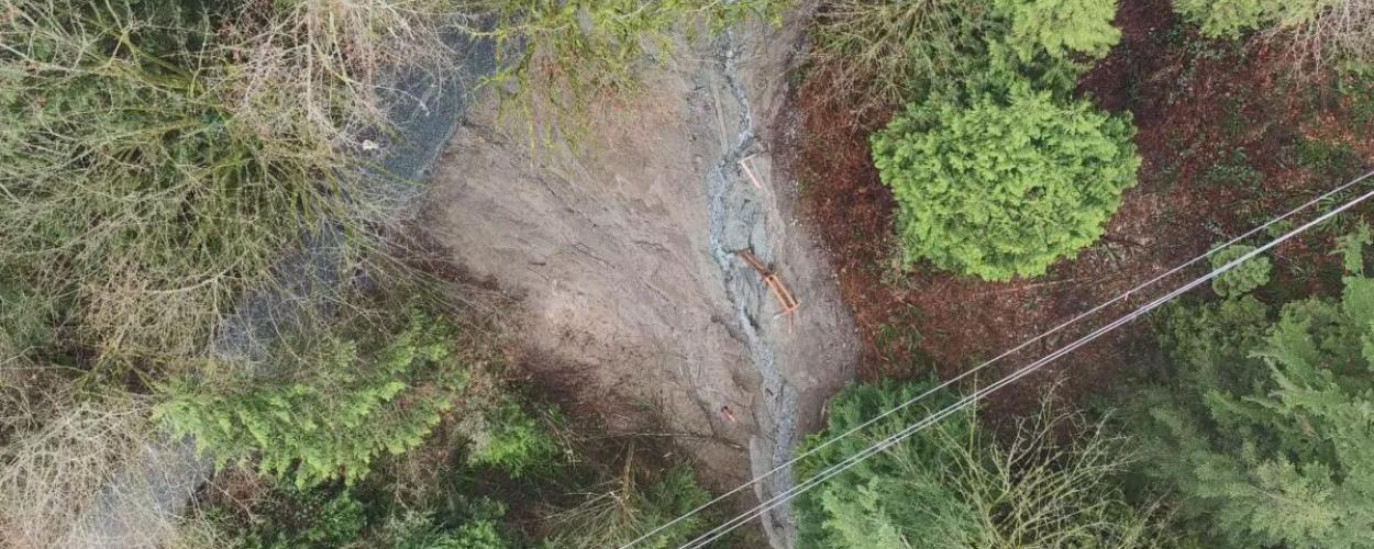
The Capilano Pacific Trail is closed due to a landslide. Please use the detour.
For your own safety, it is essential not to go past the safety fencing meant to keep people out of the unstable area. The area is susceptible to further slides, and in the event of an emergency situation, first responders will not be able to access this site. Please respect the safety fencing and stay away from this area.
December 16, 2024 Update
Per Council’s direction at their closed meeting on May 15, 2023, District staff sent a request to Metro Vancouver for financial support to preserve the Capilano Pacific Trail, including funding for a feasibility study for constructing a bridge and ongoing maintenance costs.
In October 2024, Metro Vancouver provided their response, concluding that after careful consideration, reinstating the trail in its previous alignment is not feasible given the substantial geotechnical risks involved.
In addition, Metro Vancouver expressed their shared interest in reinstating this section of the Capilano Pacific Trail, realizing the trail is a popular recreational amenity and is an important North-South connector within the Regional Greenway Network. Metro staff provided that they would welcome collaborating with the District on identifying options for a possible reroute that meets safety standards and ensures continued access to this important community asset.
We appreciate the community’s patience and updates will be provided here as further plans develop.
Capilano Pacific Trail
Capilano Pacific Trail starts at the dog walk area of Ambleside Park and follows a path along the river until signs direct you up to Keith Road. From Keith Road, head east past Klee Wyck Park and then turn north on a roadway until you reach the forest. The trail used to continue on through the Capilano River Regional Park to the Fish Hatchery, Cleveland Dam and Capilano Lake, but that is no longer accessible from West Vancouver as a result of a landslide.
- Difficulty Level: Easy
- Distance: 15 km return not including detour
- Detour: 3 km
- Elevation gain: 236 metres
- Estimated completion time: 5 hours