The Provincial Housing Supply Act mandates that the District collects and reports housing information for proposed new residential dwelling units. The Natural Environment and Hazard Development Application Form has been updated to include these additional housing details. Please ensure the most current Form is completed when submitting an application on or after April 1, 2024. For questions regarding housing forms, please contact the Planning Department via email: [email protected]
Background
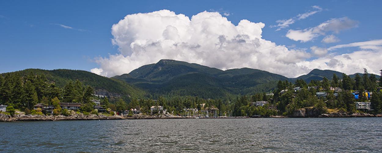
As climate change causes increased sea level rise and storm surge, it is important for waterfront communities to develop building regulations that specifically address the risk of coastal hazards and flooding.
The District of West Vancouver has created a Development Permit Area (DPA) for the foreshore (waterfront) that will help protect people and properties, provide information to owners about how to redevelop their properties safely, while sensitively managing the foreshore environment.
The Foreshore Development Permit Area was adopted on April 11, 2022. Development in the Foreshore DPA will be subject to protection area guidelines, which can be viewed under schedule ii of the Official Community Plan.
Details
The Foreshore DPA has been established to:
- Minimize risk to people and property from coastal hazards including sea level rise, storms, wave effects, and flooding.
- Support coastal management in reducing flooding risks.
- Preserve and enhance the integrity of the intertidal habitat of the foreshore and minimize shoreline erosion.
If you are planning to build a new home (i.e., habitable space) within the Foreshore DPA your proposed development must follow the District’s NE2 Foreshore Protection Area Guidelines Section I, II, and III, for the purpose of reducing the risk from coastal flood hazards on upland property and development. This includes the requirement to build habitable space to the Flood Construction Level (FCL) elevation, if the property is at an elevation that may be at risk to coastal flooding (note: FCL means the elevation of the underside of a wooden floor system or top of concrete slab for habitable buildings).
If you are planning any development, including tree work within the Foreshore Protection Area [i.e., within 15 m of the natural boundary (high tide mark) of the ocean] the development must comply with the District’s Foreshore Protection Area guidelines (see schedule ii of the Official Community Plan), for the purposes of protecting or enhancing the intertidal habitat of the foreshore.
You can view whether your property is within the Foreshore DPA under the Planning/Foreshore DPA layer in WestMap.
A Foreshore Development Permit needs to be approved prior to applying for a building permit.
-
If you are doing the following work on a property that is within the Foreshore DPA, you will need a Foreshore Development Permit:
- Subdivision of land
- Construction of, or alteration, or addition to a dwelling
- Construction of, or alteration or addition to all other non-dwelling buildings and structures, including pools, hot tubs, sheds, retaining walls, and other structures within 15 m of the natural boundary (high tide mark) of the ocean
- Alteration of land within 15 m of the natural boundary (high tide mark) of the ocean (i.e., the riparian area of the foreshore), including, and without limitation:
- Site clearing or grading
- Cutting of trees (note: if your work only involves cutting trees please refer to Tree Cutting Permit: Foreshore Protection Area webpage for permit requirements)
- Placement of fill, or disturbance of soils, rocks or other native materials for purposes other than routine maintenance of existing landscaping
- Creation of impervious and semi-impervious surfaces (such as patios and driveways)
- Installation, construction, or alteration of flood protection or erosion protection works
- Installation, construction, or maintenance of drainage, hydro, water, sewer, or other utilities
-
The following work is exempt from requiring a Foreshore Development Permit:
- Interior renovations to existing buildings
- Exterior renovations, repairs, or alterations to existing buildings or structures except when the following is within 15 m of the natural boundary (high tide mark) of the ocean:
- An increase in the size of existing structures; or
- Removal and reconstruction of structures
- Installation of fences that allow for passage of water and does not require removal of trees
- Emergency works, including tree cutting, necessary to remove an immediate danger or hazard, as certified by an Arborist
The following are exempt from the requirement to meet the FCL:
- Recreation shelters, stands, washrooms and other outdoor facilities designed to withstand periodic flooding
- Renovation of an existing building or structure.
- Construction of a portion of a building or structure that is used as a carport or garage
- Accessory buildings such as storage buildings, porches, and domestic greenhouses that is not habitable space
- An addition, below the minimum FCL elevation that would increase the size of the building or structure less than 25% of the existing floor area
- Commercial space (restaurants, offices, retail space)
-
Your application for a Foreshore Development Permit should include the following:
- Completed Natural Environment and Hazard Development Permit Application Form
- If applicable:
- an Environmental Assessment prepared by a Qualified Environmental Professional (i.e. Registered Professional Biologist) with experience in the assessment of intertidal marine habitat, which describes the proposed development within 15 m of the natural boundary (high water mark) of the ocean, and how the development complies with the District’s NE2 Foreshore Development Permit Area Guidelines Section IV, including consideration for the protection of the intertidal habitat and upper riparian habitat of the foreshore (e.g., describes existing environment and the environmental protection measures proposed to mitigate impacts)
- a Coastal Engineering Report prepared by a Professional Engineer (note: only required if you decide to have a site specific FCL elevation and setback calculated by a Professional Engineer (i.e., Coastal Engineer) which is specific to your property instead of using the conservative FCL provided in the District’s NE2 Foreshore Development Permit Area Guidelines Section II) or if any work is proposed for coastal hazard protection of the property under Guidelines Section IV
- The Coastal Engineering Report must include the following:
- A Flood Hazard Assessment completed for the property identifying:
- the site specific FCL and setback calculated for the site
- A cover page signed and sealed by a Professional Engineer with:
- a statement certifying that the Coastal Engineer has reviewed the architectural drawings, and that the flood risk mitigation measures have been implemented into the building plans
- A statement certifying that the lands may be safely used for the use intended
- any maintenance requirements to keep the extant flood mitigation work in such a condition that the engineer’s certification, that the land may be safely used for the use intended, continues to apply
- A Flood Hazard and Risk Assurance Statement
- A Flood Hazard Assessment completed for the property identifying:
- The Coastal Engineering Report must include the following:
- Architectural Drawings showing that proposed habitable space meets the District’s NE2 Foreshore Development Permit Area Guidelines Section I (see schedule ii of the Official Community Plan) and recommendations from the Coastal Engineer, if applicable.
- Landscape Plan showing proposed hardscaping (note: this must include all impervious and semi impervious surfaces, retaining walls etc.) and proposed softscaping (e.g., coastal plant species proposed, replacement trees if tree removals are proposed etc.) within 15 m of the natural boundary (high tide mark) of the ocean
- Arborist Report prepared by an ISA Certified Arborist inventorying the “Protected” trees on the property and meeting the criteria set out in the District’s Tree Bylaw, Section 8.2
-
Applicants must submit all necessary documentation as outlined above. Plans and documents must be in PDF format and submitted to:
Environmental Protection Officer
Email
All fees can be paid online. Directions for online payment will be provided to the applicant following the application submission.
Foreshore Development Permits can typically be processed in 4-6 weeks, however, process time varies depending on whether or not there are any other Development Permits required (e.g., wildfire or watercourse protection), the completeness and accuracy of the reports, information received, and the overall complexity of the project (note: if variances to the Zoning Bylaw are requested, processing times will be longer). -
Did you provide a security deposit for a development permit that the District may still be holding even though the project is complete or was cancelled?
If you think you have a security deposit that you haven’t claimed, please search our database here.
-
- Why is foreshore protection needed?
Oceanfront homes are in high demand in West Vancouver, but building too close to the ocean can increase the risk of damage to homes from flooding and sea level rise due to climate change and can also damage the foreshore. It is a priority for the District to address this threat by preparing strategies to protect the shoreline and waterfront properties.
- Which properties are included in the Foreshore DPA?
Waterfront properties and upland properties below the FCL calculated and provided in the District’s NE2 Foreshore Protection Area Guidelines Section II, which are potentially at risk to coastal flooding. Under the Planning/Foreshore DPA layer in WestMap, you can view whether your property is within the Foreshore DPA.
- When would I need a Foreshore Development Permit?
If your property is in the Foreshore DPA and you are planning to build a new house, or subdividing the land, or are planning any development including tree work within 15 m of the natural boundary (high tide mark) of the ocean, a Foreshore Development Permit is required.
- For the guidelines for the protection of the natural environment, is the 15 meter setback from the current natural boundary or future estimate natural boundary as it is mentioned in the guideline to calculate the FCL?
In order to protect the existing state of the foreshore environment, the 15 m buffer area from the natural boundary will use the natural boundary at the time of the proposed work.
- How do I determine the 15 m setback from the natural boundary (high tide mark) of the ocean?
Natural boundary is defined as the visible high water mark of any lake, river, stream or other body of water where the presence and action of the water are so common and usual, and so long continued in all ordinary years, as to mark on the soil of the bed of the body of water a character distinct from that of its banks, in vegetation, as well as in the nature of the soil itself.
For most waterfront properties the natural boundary is similar to the waterfront property line. The 15 m setback from the waterfront property line can be determined by using the measuring tool on WestMap. This method of determining the setback will be acceptable if a Legal Survey has not been completed, however for new homes which will require a legal survey for building permit applications, both the natural boundary of the ocean and 15 m setback from the natural boundary must be shown on the survey.
- What do I need to apply for a Foreshore Development Permit?
Your application for a Foreshore Development Permit should include the following:- Completed Natural Environment and Hazard Development Permit application form
- If applicable:
- an Environmental Assessment prepared by a Qualified Environmental Professional (i.e. Registered Professional Biologist) with experience in the assessment of intertidal marine habitat, which describes the proposed development within 15 m of the natural boundary (high water mark) of the ocean, and how the development complies with the District’s NE2 Foreshore Development Permit Area Guidelines Section IV, (see schedule ii of the Official Community Plan) including consideration for the protection of the intertidal habitat and upper riparian habitat of the foreshore (e.g., describes existing environment and the environmental protection measures proposed to mitigate impacts).
- a Coastal Engineering Report prepared by a Professional Engineer (note: only required if you decide to have a site specific FCL elevation and setback calculated by a Professional Engineer (i.e. Coastal Engineer) which is specific to your property instead of using the conservative FCL provided in the District’s NE2 Foreshore Development Permit Area Guidelines Section II) or if any work is proposed for coastal hazard protection of the property under Guidelines Section IV
- The Coastal Engineering Report must include the following:
- A Flood Hazard Assessment completed for the property identifying:
- the site-specific FCL and setback calculated for the site
- A cover page signed and sealed by a Professional Engineer with:
- a statement certifying that the Coastal Engineer has reviewed the architectural drawings, and that the flood risk mitigation measures have been implemented into the building plans
- A statement certifying that the lands may be safely used for the use intended
- any maintenance requirements to keep the extant flood mitigation work in such a condition that the engineer’s certification, that the land may be safely used for the use intended, continues to apply
- A Flood Hazard and Risk Assurance Statement
- A Flood Hazard Assessment completed for the property identifying:
- The Coastal Engineering Report must include the following:
- Architectural Drawings showing that proposed habitable space meets the District’s NE2 Foreshore Development Permit Area Guidelines Section I (see schedule ii of the Official Community Plan) and recommendations from the Coastal Engineer, if applicable.
- Landscape Plan showing proposed hardscaping (note: this must include all impervious and semi impervious surfaces, retaining walls etc.) and proposed softscaping (e.g., coastal plant species proposed, replacement trees if tree removals are proposed etc.) within 15 m of the natural boundary (high tide mark) of the ocean.
- Arborist Report prepared by an ISA Certified Arborist inventorying the “Protected” trees on the property and meeting the criteria set out in the District’s Tree Bylaw, Section 8.2
- Where can I find Coastal Engineer?
The District’s Environmental Protection Staff maintain a list, however we will not recommend one company over another.
- I am only doing an interior renovation. Do I still need to get a Foreshore Development Permit?
No. Interior renovations to existing buildings are exempt from requiring a Foreshore Development Permit.
- Can I apply for my Foreshore Development Permit at the same time as my building permit?
No. The Foreshore Development Permit must be obtained prior to applying for a building permit. Any conditions in the approved Development Permit must be addressed at the building permit stage.
- I have my Foreshore Development Permit. Can I now undertake the tree work slated for removal or pruning?
Yes, tree work within the Foreshore Protection Area (within 15 m of the natural boundary of the ocean) can proceed with an approved Foreshore DP. For other Protected Trees as defined in the District’s Tree Bylaw or for trees on District Land, a separate Tree Cutting Permit may be required at the building permit stage.
- How will the Foreshore DPA affect my property for future development?
Any new development on a property within the Foreshore DPA will need to comply with the Official Community Plan NE2 Foreshore Protection Area Guidelines to reduce the risk from coastal hazards to people and property, and protect the intertidal habitat of the foreshore.
- Will the Foreshore DPA affect how large of a home I can build?
Potentially, the building footprint/height may need to be adjusted to reflect development permit requirements.
- How long does the Foreshore Development Permit process take?
Foreshore Development Permits can typically be processed in 4-6 weeks, however, process time varies depending on whether or not there are any other Development Permits required (e.g., development permits for watercourse protection or wildfire hazards), the completeness and accuracy of the reports, information received, and the overall complexity of the project. If variances to the Zoning Bylaw are requested, processing times will be longer, please contact the Planning Department for timelines ([email protected]).
- How much does a Foreshore Development Permit cost?
The fees are set out in the Fees and Charges Bylaw.
- What do I submit if the property falls within multiple DPAs?
If there are assessments by multiple Qualified Professionals/Engineers, they need to be coordinated and integrated for the application submission to ensure all DPA guidelines are met.
- I want to do work on the public foreshore. Do I need a Foreshore Development Permit for work proposed on the public foreshore?
Any work proposed on the public foreshore, including work on existing encroachment structures, is administered under a separate process. For work proposed on the public foreshore the District’s Zoning Bylaw 4662, 2010, and conditions of the Head Lease with the Province will apply. If you are proposing shoreline protection work on the public foreshore, the District has developed an Interim Framework for Proceeding with Shoreline Protection Projects which identifies what you need to include in your application for shoreline protection works and can be provided upon request.
If your property is located on Pasco Road or Eagle Island and you are applying for a foreshore encroachment, you can access the Foreshore Encroachment Application Checklist here.
Your application for public foreshore work can be processed concurrently with the Foreshore DP process if you are also proposing work on private property within the Foreshore Protection Area.
- Is there any involvement by Fisheries and Oceans Canada in the waterfront development process, current, or proposed?
If work is proposed within the public foreshore area, there is a requirement under the District’s Head Lease with the Province to ensure approval from all levels of government. The District requires an assessment from a Qualified Environmental Professional to determine whether an Authorization is required from Fisheries and Oceans Canada. For work done on private property, again, it is the responsibility of the applicant to ensure they are adhering to regulations from all levels of government. This is a guideline under the Foreshore DPA.
- Would each individual homeowner developer be required to retain their own coastal engineer and FCL report?
The District’s NE2 Foreshore Development Permit Area Guidelines Section II include area-FCLs that were calculated by the District. A property owner could choose to use the applicable area FCL for development of their property or retain their own coastal engineer to complete a Flood Hazard Assessment to calculate a site-specific FCL.
- Instead of using the area FCL provided in the NE2 Foreshore Development Permit Area Guidelines Section II, how do I determine a site-specific FCL for my property?
Retain a Professional Engineer (i.e., Coastal Engineer) to calculate a site-specific FCL for your property, using the methodology outlined in the Provincial Flood Hazard Area Land Use Management Guidelines.
- If the area of my property where I want to build a new house is higher than the area FCL determined by the District, is my proposed work still subject to the Foreshore DPA guidelines?
If you are proposing work within the Foreshore Protection Area (i.e., within 15 m of the natural boundary of the ocean) then your work is subject to the District’s NE2 Foreshore Development Permit Area Guidelines Section IV. This is because work in the Foreshore Protection Area can still negatively impact fish and fish habitat below the FCL.
If the proposed building location is higher than the FCL, than the proposed building would be exempt from the requirement of obtaining a development permit.
- If the zoning setback from the waterfront property line is less than the Foreshore Protection Area setback of 15 m from the natural boundary of the ocean, are we allowed to locate the principal structure up to the?
Yes, the environmental riparian buffer zone could be larger than the zoning setback for a single family property. This would not restrict a house from being developed within its permitted building envelope even if it encroaches into the Foreshore Protection Area; however, the District’s NE2 Foreshore Protection Area Guidelines require an assessment from a Qualified Environmental Professional to ensure any new structures do not negatively impact the sensitive foreshore environment and provide recommendations to ensure long-term protection of this area.
- Why is the FCL different across properties?
The FCL differs across properties primarily because of the wave effects component of the calculation. Depending on site topography, where a property is located on the coast, and what features are on the property (seawalls, etc.), the wave run-up onto a property can vary, thereby, resulting in changes in the FCL.
- How will storm run off from raised properties be addressed regarding impact on neighbours and on the erosion of the foreshore?
A stormwater management plan, prepared by a Professional Engineer, is required at the building permit stage. The plan needs to consider overland flow paths for both controlled and uncontrolled flow and demonstrate that water flow will not be diverted onto a neighbouring property. Features such as cut off ditches, perimeter drainage for any retaining walls, or other such measures will need or could be introduced in order to address any grade differentials. The District’s Land Development Department has guidelines for stormwater management.
- This seems to apply to individual private properties, I'm in a 100 unit building right on the Seawalk. The building can't be moved obviously. What can be done to mitigate the risk of flooding for our building?
Yes, the FCL requirements are only applicable to new developments with living space; however, a Professional Engineer (i.e., Coastal Engineer) or a Qualified Environmental Professional could be engaged to assess the flood impacts to a property and provide recommendations to mitigate future flooding and damage to existing houses/buildings.
- If properties currently protected by seawalls are at risk, is your expectation to have the seawall height raised, or are other designs considered?
Each property will need to identify the appropriate design to protect against coastal flooding and redevelopment to the FCL. The guidelines specify the need to engage with a Professional Engineer to determine the most appropriate flood mitigation measures for a property.
- Do the District’s NE2 Foreshore Development Permit Area Guidelines apply to building near a creek?
The District has an Environmental Development Permit Area already in place for protection of riparian areas and creeks. Further information can be found here.
- Is riprap following the natural slope acceptable?
If there are proposals to naturalize an area, the District is looking primarily for softer materials versus riprap. However, given that some properties are exposed more significantly to wave and wind action, riprap armouring could sometimes be the best option. If riprap is proposed for a shoreline, it is a requirement that a coastal engineer design the slope and provide rationale for the best materials to use, based on site conditions.
- Why is foreshore protection needed?